
In the world of Digital Twins, there is only one Visual Twin. Bring changes to your area to life in stunningly realistic 3D with our Visual Twin.
Recognizability in moving images
Changes in the spatial domain always have an impact on the environment, and therefore also on those involved such as local residents. After all, the existing image is replaced by something new. Something is added or removed. What was recognizable will soon no longer be so. And this raises questions. For this reason, it is crucial to create clarity from the start of a process, by communicating transparently and honestly with all parties involved. By giving them a recognizable and realistic image of de your plans, create support and prevent your project from being delayed.
Reliable, accurate and understandable
We have over 20 years of experience in creating realistic and reliable visualizations. We work on the basis of available and accurate environmental data, so that the positions and heights of objects always correspond to the place where they are (or will be) located in reality. So we do not make estimates, but create an honest and realistic picture of your project.
When creating the Visual Twin we use various techniques such as Photogrammetry and point clouds that we process in Unreal Engine.
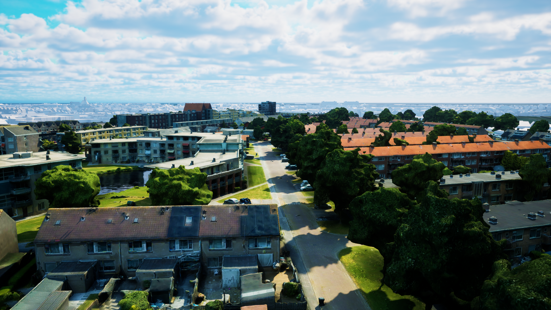

High realism in the picture
We introduce our new service with Visual Twin: Animation. We integrate proven and reliable techniques into dynamic images. We use the most advanced solutions.
So we don't create videos just for the pretty picture, we also stick to the principle of the realistic image. The honest story, as you are used to from us, but in motion.
Involve our visualizations from the early project stages
Combine our visualization service with it Stakeholder Engagement Platform. This is a visual tool in which we make project information accessible through appropriate, interactive visualizations and map material. With the help of the map layers, we can visualize your project information from the first phase. We can integrate the Area Participation Platform into your own project environment.
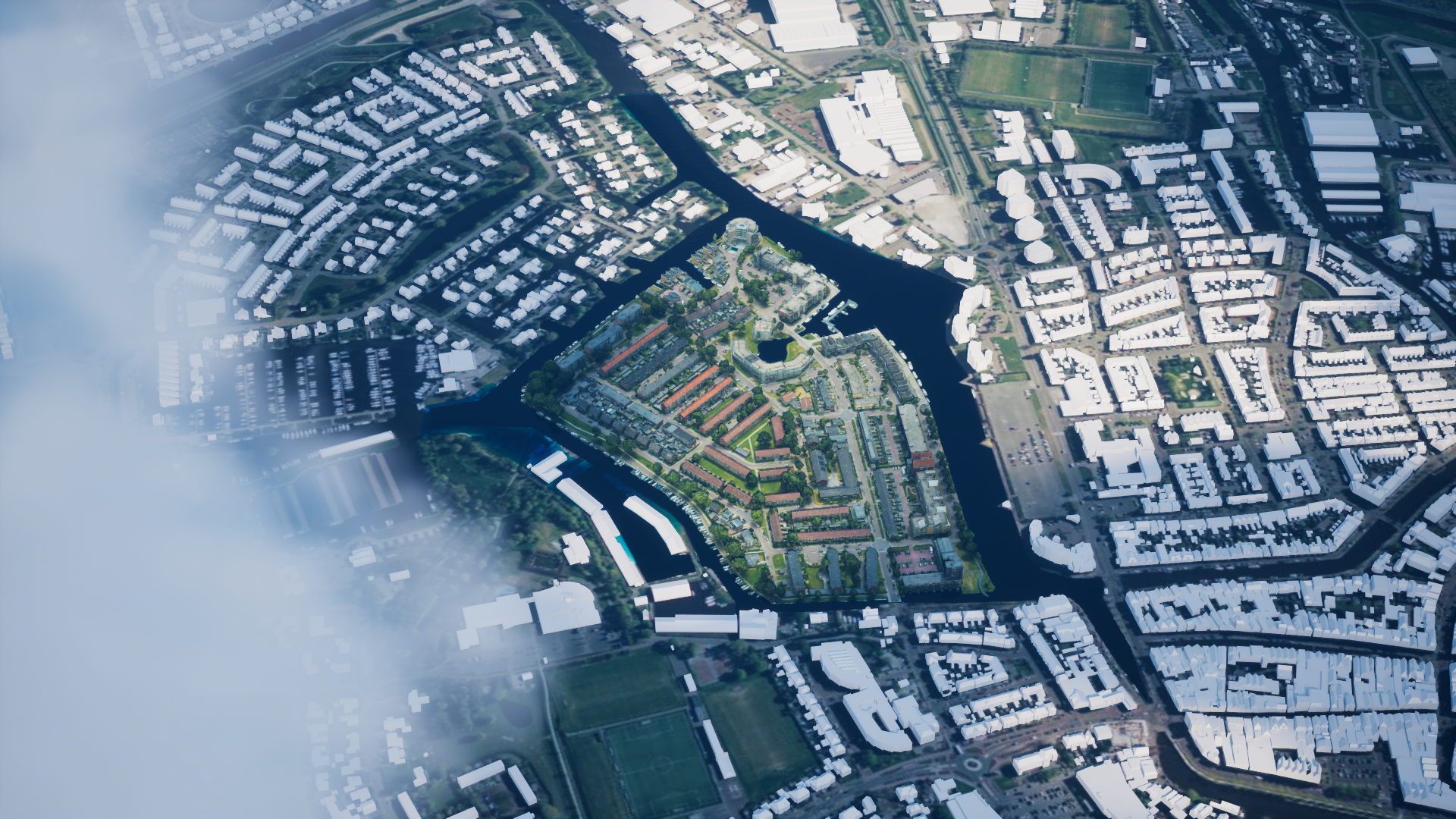
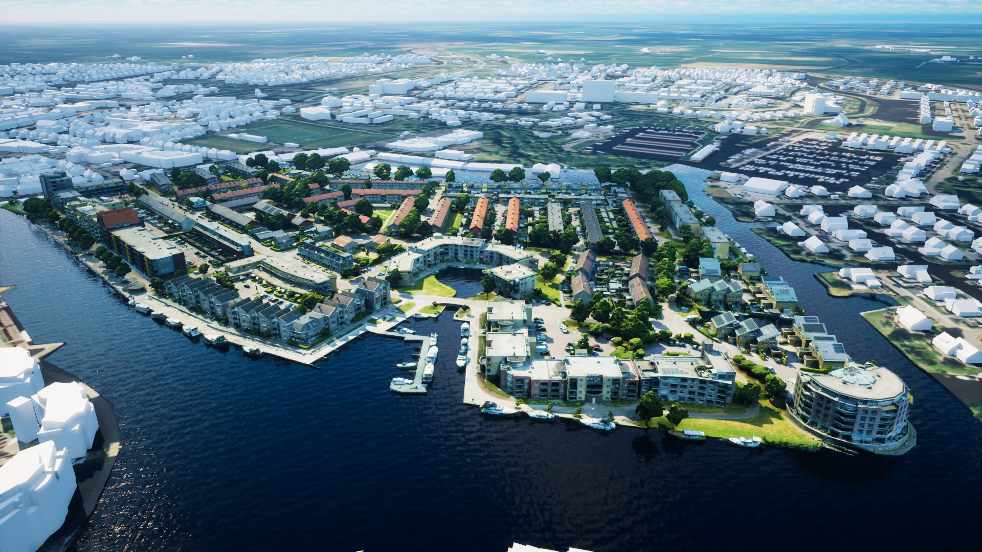
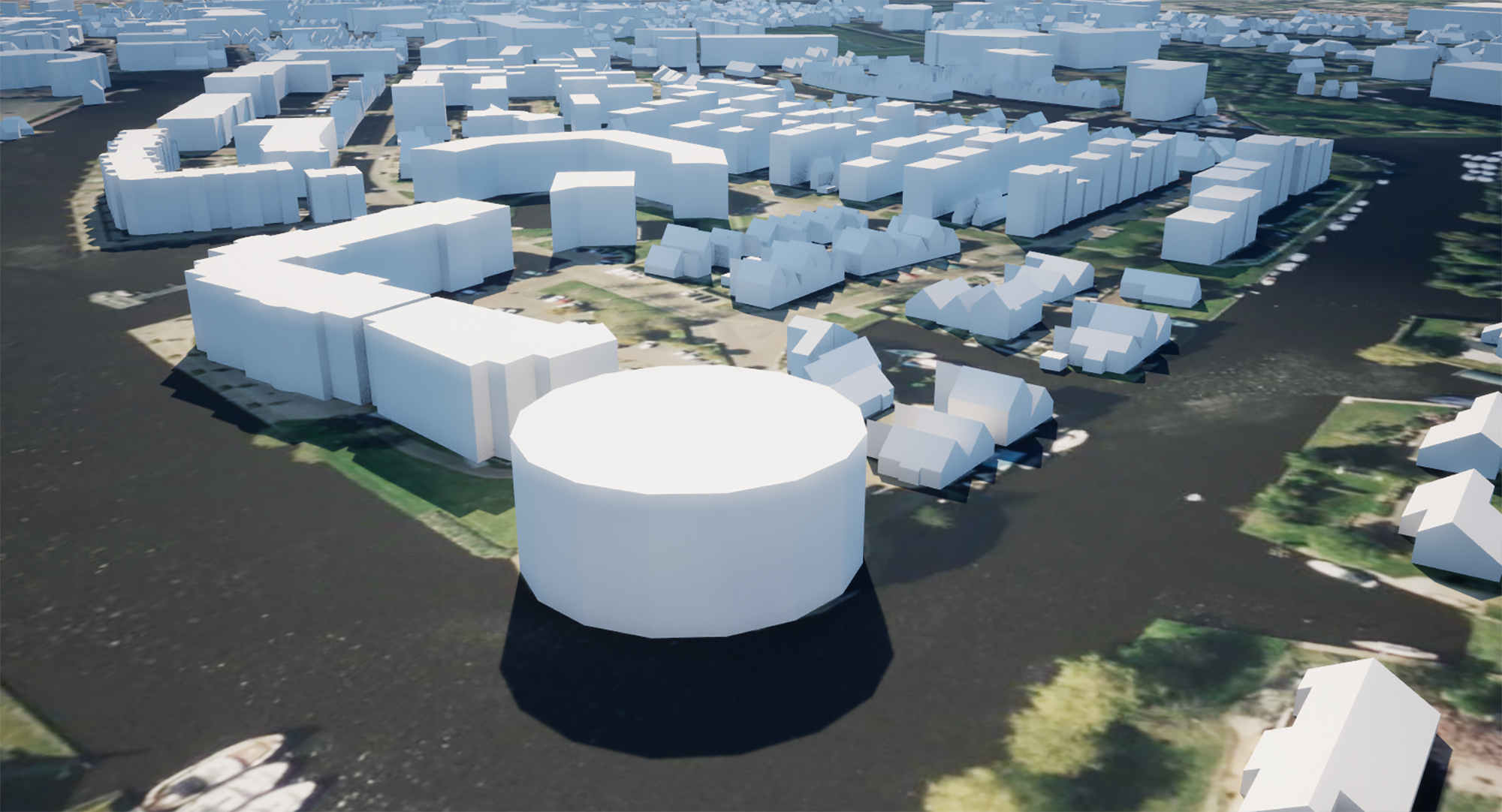
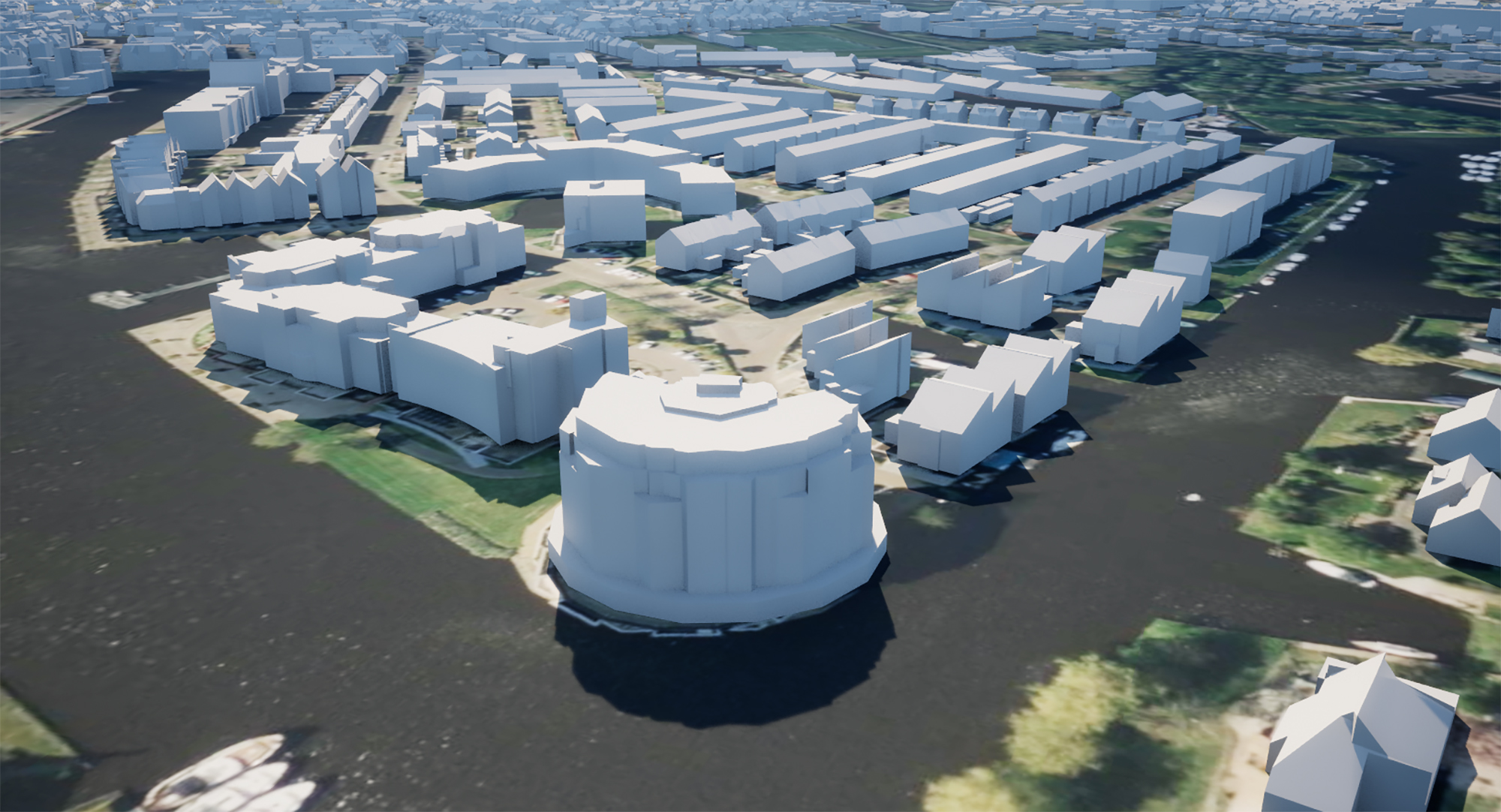
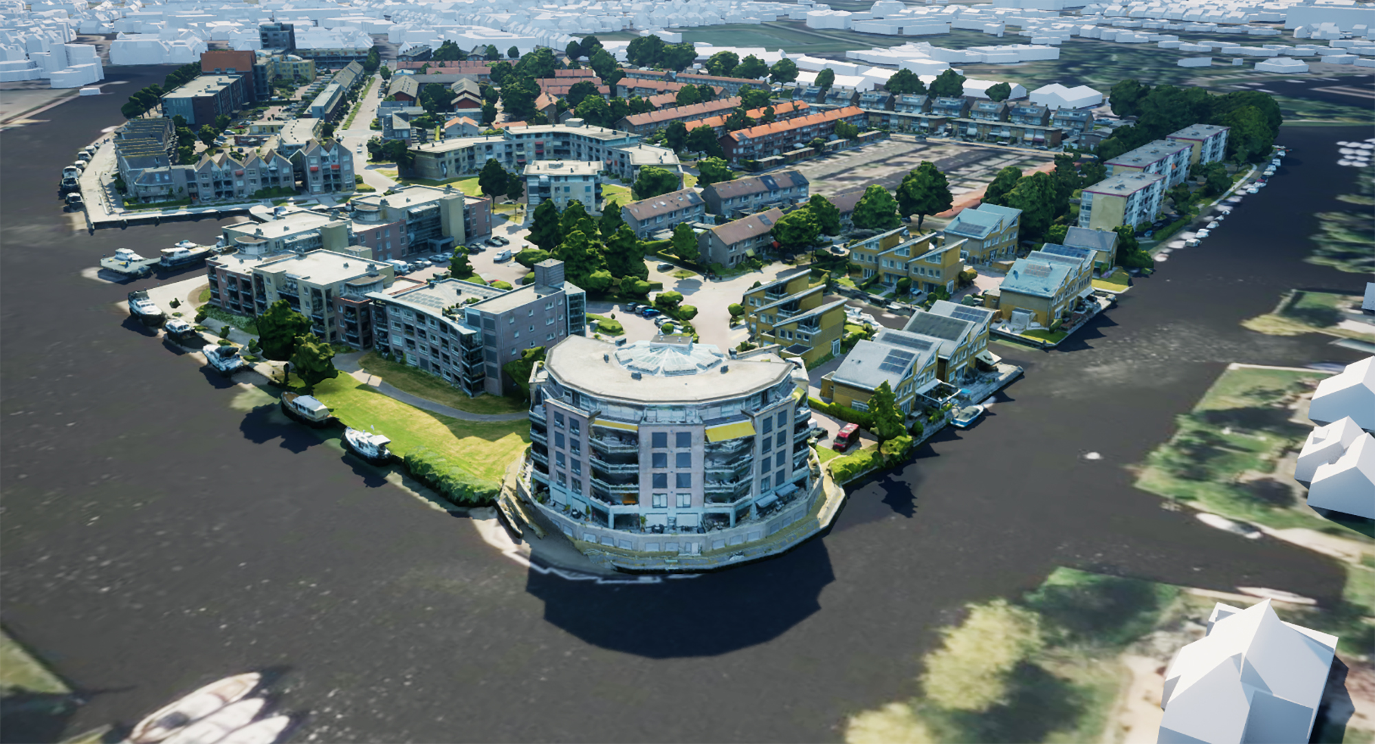
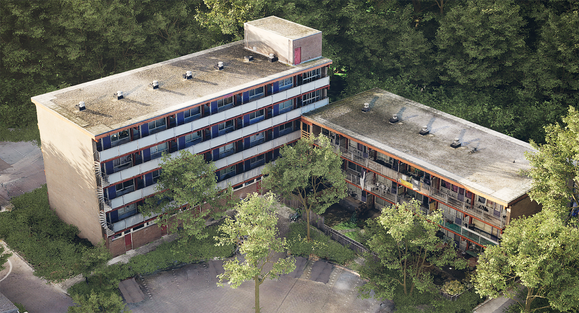
Level of detail


Level 1
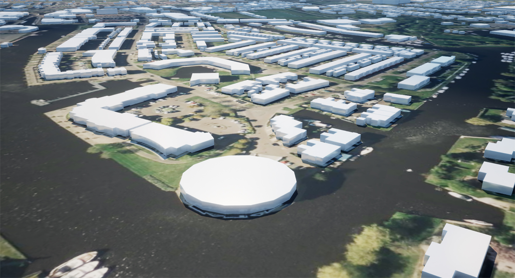
Level 2
Level 3
Level 4
Level 5

Various expressions are possible
- As a downloadable animation (MP4 file) for presentation on screen.
- Placed as a video on a YouTube or Vimeo account for presentation on a website.
- As content within the Area Participation Platform.
Suitable for almost all file formats
Have you already developed your project information to a certain extent in 2D or 3D? Even then we can do enough for each other: we can include supplied models in our own software package. We may be able to smartly reuse all the information that is already present in your organization. This saves duplication of work and reduces costs. We can handle almost all common file formats. This creates good integration with third-party content.
Integration with our Planner Digital Twin
This content can also be used as an integration with our Digital Twin – Windplanner.
Curious what that looks like? Request a demo of starts a 14 day test version of our Windplanner software.
Portfolio


